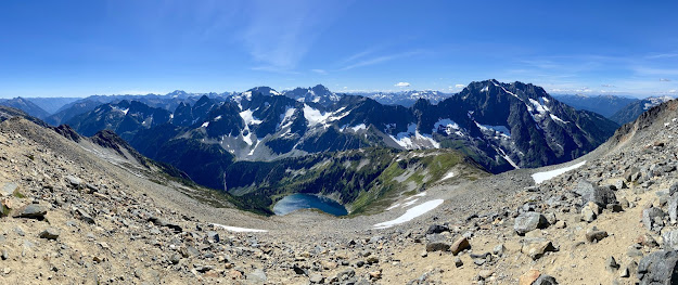
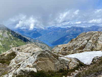
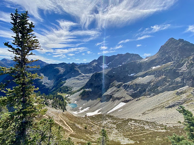
North Cascades National Park embodies a section of the Cascade Range that spans the border between Washington and Canada. The alpine wonderland contains cascading waters in forested valleys and jagged peaks crowned by more than 300 glaciers. Relative to other larger national parks, the North Cascades is manageable in size, which makes trip planning less overwhelming.
The best weather for visiting typically occurs between mid-June and late-September. The east side of the Cascade Mountains is drier and warmer in the summer (90's F) than the temperate rainforest of the west side. The various landscapes, ecosystems and habitats that span the Cascade Crest result in a high diversity of plants and animals including black bears, mountain goats, marmots, pika, butterflies, wildflowers, and mountain blueberries. The relatively new mountains, glaciers and streams lie near a dynamic interface of tectonic plates and provide an opportunity to study geologic processes unfolding over time.

8/29/20 - 9/3/20
SATURDAY (DAY 1): Olympic Peninsula
The quickest route north from Portland to the North Cascades is just shy of 5 hours, but Tom and I began our trip with a more scenic route. We added an extra hour by way of Highway 101 along Washington's Olympic Peninsula. From Port Townsend, we took a
ferry to Coupeville, stopping for an Italian dinner at
Ciao. That evening, we arrived in Marblemount, where we would spend the next 3 nights at
Buffalo Run Inn--a modest stay located on the park's western boundary.
Date: 8/30/20
Stats: 12-mile out-and-back, 4,000' gain, 7,570' peak
Synopsis: A heavily-trafficked trek that ambles peacefully through rolling alpine meadows blanketing the broad shoulder of Sahale Mountain. This park-like setting is made more spectacular by contrast with the dramatic mountainous terrain that stretches in every direction.
Highlights:
- Home to black bears, mountain goats and marmots
- Best views, second favorite trail
- 9:30pm-4pm RT
MONDAY (DAY 3):
Hidden Lake LookoutDate: 8/31/20
Stats: 8-mile out-and-back, 3,300' gain, 6,900' peak
Synopsis: Varied terrain ranging from wildflower meadows to stark granite that leads to a historic lookout shelter with an intimate view of the heart of the North Cascades.
Highlights:
- Final 5 miles to trailhead require 4WD/high clearance vehicle
- Bouldering, snowy patches and route finding required
- Would be top 3 in clear, dry conditions
- 9am-3pm RT

Clear conditions
TUESDAY (DAY 4):
Mt. Baker Scenic BywayTuckered from two days of hard hiking, Tom and I decided to trade our plan to trek
Thornton Lakes/Trappers Peak (honorable mention
Easy Pass) for a rest day. Winding along the banks of the Nooksack River, through small logging communities, waterfalls and old-growth forest groves, Mt. Baker Scenic Byway is a 58-mile drive that ends at the base of the 10,781' volcano, Mt. Baker.
At Nooksack Falls, the Nooksack River flows through a narrow gorge and drops 88' into a deep rocky river canyon.
Picture Lake is the centerpiece of a strikingly beautiful landscape in the Heather Meadows area. The classic alpine vista of Mt. Shuksan mirrored in Picture Lake is stunning against the colorful plant foliage.


Located at the end of the byway, Artist Point offers 360-degree views of Mts. Shuksan and Baker, as well as access to a variety of trails. Due to excessive annual snowfall, the area is only open from late July to early October.
Back in the heart of the park, Tom and I set up camp that evening at
Newhalem Campground.
How natural it is to free yourself from all worries and sleep under the stars.
WEDNESDAY (DAY 5):
Sourdough Mountain LookoutDate: 9/2/20
Stats: 10.4-mile out-and-back, 4,870' gain, 5,985' peak
Synopsis: A strenuous yet rewarding challenge that alternates through charming groves of sub-alpine forest and open meadows of vibrant wildflowers. From the lookout, 360-degree views of glaciated peaks line the horizon high above the turquoise waters of Diablo and Ross Lakes.
Highlights:
- Home to one of the first lookouts established by the U.S. Forest Service, which was frequented by several beatnik poets
- 1,000' climb per mile for 5 miles (equivalent to Mt. Defiance in the Columbia River Gorge)
- 9am-3pm RT

Clear conditions
Our final night took us to the drier east side of the park at the
River Run Inn. Our cozy cabin patio overlooked the tranquil Methow River and its large deer population. Tom and I ventured into the neighboring cowboy town, Winthrop, and enjoyed a hot meal at
East 20 Pizza.
THURSDAY (DAY 6):
Heather-Maple PassDate: 9/3/20
Stats: 7.2-mile loop, 2,000' gain, 6,650' peak
Synopsis: A heavily-trafficked trail that satisfies all hikers' desires, featuring ridge lines blanketed in wildflowers and a sea of peaks extending in every direction.
Highlights:
- Follow the loop counter-clockwise, and take the short detour to the shores of Lake Ann, a glacial cirque cradled in a talus bowl
- Favorite trail
- 9am-12:30pm RT
Tom and I once again chose the longer, scenic route home through
Lake Chelan National Recreation Area, which rests in a glacially carved trough in the pristine Stehekin Valley. Fjord-like Lake Chelan is one of the nation's deepest lakes, extending 50 miles into the Cascade Mountains. I am excited by the thought of spending more time here in the future.
Tom and I continued driving south through central Washington, into the haze of a smoky wildfire (foreshadowing what was to come), before emerging in the Columbia River Gorge at sunset. I am eternally grateful for this wonderful opportunity to reset, slow down and connect with nature while staying active.


![r/EarthPorn - The mile elevation gain up to Sourdough Mountain was worth it. Diablo, WA [4096x3230]](https://external-preview.redd.it/BAczKpz1l6XldkWAcuvH5ptBsJi7cptgzZ-CLnNpwdA.jpg?width=960&crop=smart&auto=webp&s=53e833df17c74df8e43effaf75640313e00e979f)


