Saturday, May 18, 2019

Augspurger Mountain

Date hiked: 5/13/19

As I transitioned to working 40+ hour weeks between OHSU and Pharmaca, I spent a much-needed day off in the Gorge. Located an hour east on the Washington side of the Columbia River, Dog Mountain is a popular but difficult hike. I was first introduced to it at the end of last summer, but Aunt Judy convinced me to repeat it for the springtime wildflower display (typically in late May/early June).

I arrived to the Dog Mountain Trailhead at 10am on Monday, shocked to snag one of the last parking spots--word had apparently gotten out that the flowers had bloomed early this year. Instead of taking the Dog Mountain Trail, I switched it up by starting on the Augspurger Trail to make a 7.4 mile loop (2,800' gain).


The Augspurger Trail starts climbing immediately out of the parking lot. The path crosses multiple talus slopes, leading to views of Wind Mountain and the Columbia River to the west. The morning was overcast, but it was the last dry day before a stretch of rain.


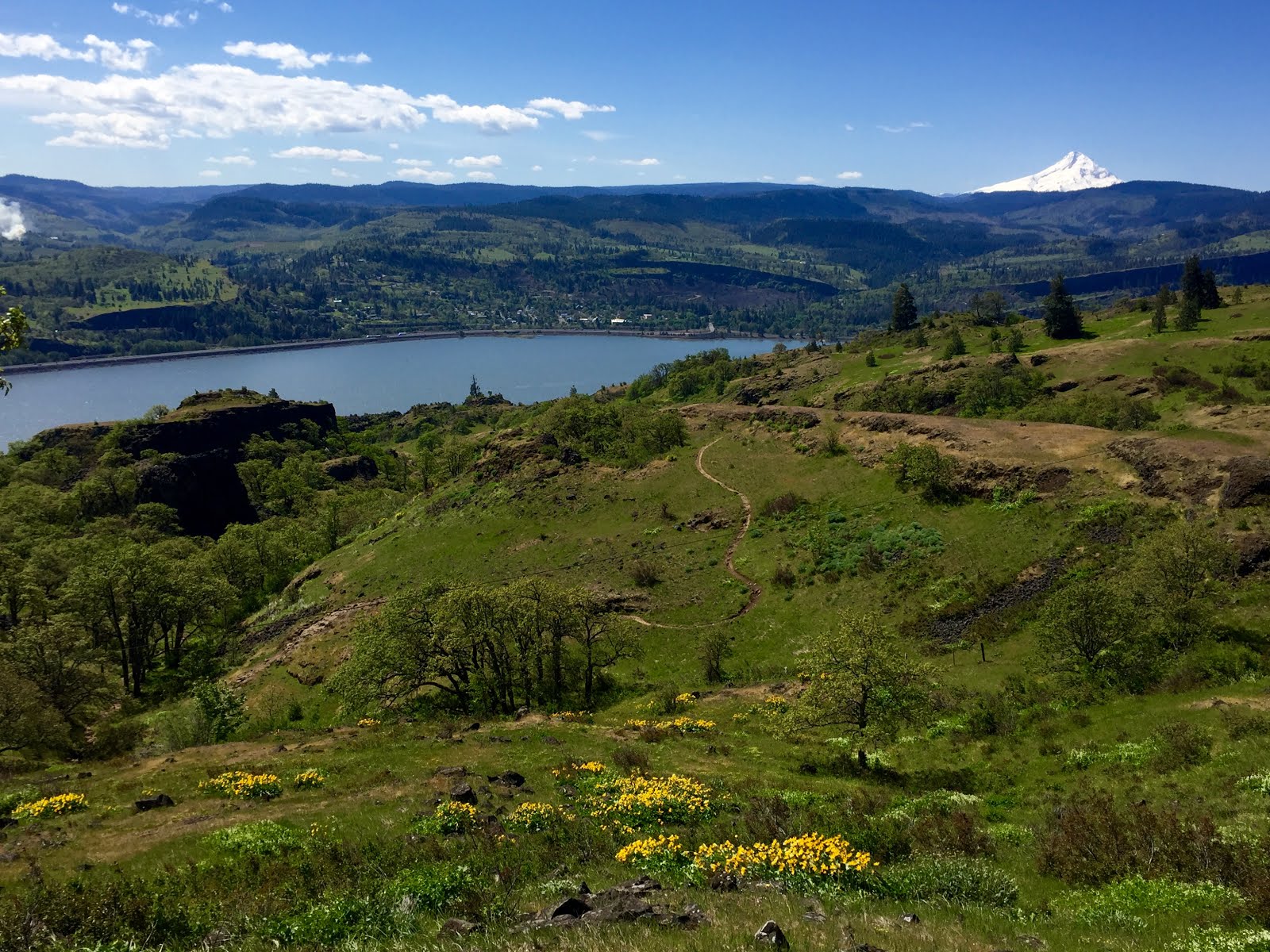
After three miles, in lieu of continuing on to the summit of Augspurger Mountain, I turned at a junction to connect to the Dog Mountain Trail. From here, a brief climb breaks out into the summit meadows. The yellow balsamroot hadn't quite peaked, but it was certainly close--vaguely reminiscent of scenes from The Sound of Music.


Another junction lies almost a mile ahead. Turning left to continue upward on the Summit Loop Trail leads to the windy summit of Dog Mountain. A wild turkey was hanging around up top, unfazed by the crowd of people taking its picture.


Backtracking down the Summit Loop Trail, the clouds began to clear out to reveal a beautiful afternoon. I could just make out the snowy peaks of Mts. Hood and St. Helens in the distance.


About a half mile later, I reached Puppy Dog Lookout.


From there, I followed the trail back down into the forest before reaching the lower viewpoint. I returned to the trailhead by 2pm.


The drive home that afternoon was just lovely, riding the high from the hike and surrounding natural beauty; so very enchanted by the PNW.


Sunday, May 12, 2019

Oregon Health & Science University

May ushered in a delightful glimpse of the summer warmth and sunshine to come. It was tempting to spend all of my time outside. Ironically, however, I recently discovered my new go-to spot on rainy days; Khora Coffeehouse operates out of a cozy, 1904 craftsman house; easily the best neighborhood cafe nearby!


My last free weekend before starting a new job, Tom hosted a veggie barbecue for his friends at his family's property in outer northwest Portland (a 40-minute drive from southeast). The 30-acre forested land has been passed down for several generations in the Marshall family. Its refreshing and peaceful tranquility is the perfect escape from the city. One of my favorite Sundays of late!


While still working part-time at Pharmaca Integrative Pharmacy, I took on another relief position at Oregon Health & Science University (OHSU). The well-respected, public organization is the only academic health center in Oregon. Having completed my pharmacy internship in the UPMC system in Pittsburgh, I am excited to return to the clinical setting as I begin my work in the hospital pharmacy.


OHSU owns several hospitals and clinics across Oregon, but its main hospital is located in southwest Portland on top of Marquam Hill. The 100-acre campus is quite literally nestled within a forest--and it is beautiful. The view from campus expands across town to Mt. St. Helens, Mt. Hood, Mt. Tabor and Rocky Butte.


Transportation to and from the hospital is tricky, so I've been experimenting with a 20-minute bike commute to the South Waterfront via the Tilikum Crossing--a cable-stayed bridge that solely serves public transit, cyclists and pedestrians--followed by a quick ride up the hill via the aerial tram.


Located at the base of the tram, Go By Bike runs the largest bike valet in North America. The free service efficiently and safely parks over 100,000 bikes a year. The organization also offers repairs and operates the OHSU bike share program. It will be a long time--if ever--before I get sick of this commute.


Friday, May 3, 2019

Coyote Wall

Date hiked: 5/1/18

The Coyote Wall-Labyrinth Loop is a 7.7-mile (1,200' gain) hike that offers great views of the Columbia River Gorge along with enchanting stands of oak, cascading waterfalls, basalt cliffs, and profuse wildflowers in the spring. Often sunny here while raining in town, it is a great place to hike while waiting for snow to melt at higher elevations.


The Coyote Wall Trailhead is located 1.5 hours east of Portland, crossing to the Washington side of the Gorge via the Hood River toll bridge and following Highway 14 to Bingen. For a more scenic route, take Highway 14 all the way from Vancouver.

The trailhead provides access to an extensive trail network (bring a map!) suited for hikers, mountain bikers and equestrians. The loop hike begins with a walk along an old highway to the Labyrinth Trail. Start: 10:30am.


For the next two miles, the trail weaves up though grassy plateaus, a creek with cascades and a waterfall, rocky protrusions, talus slopes, and dramatic views of the Gorge. The weather was perfect with less wind than usual.


At the top of the loop, the Upper Labyrinth Trail breaks out onto a grassy slope with unhindered views of the Columbia River. This time of year, there is a steady progression of wildflowers, including yellow balsam root. Beware, however, of rattlesnakes and poison oak on the path.


Turning left on the Atwood Road Trail, an abandoned road travels back into a grove of trees, drops slightly to cross a stream, then goes uphill to join an old Jeep road. Snowy Mt. Hood can be seen across the Gorge. **Side note from Aunt Judy: from here, follow the Upper Coyote Wall Traverse Trail to climb to an open field of wildflowers. I was trying to follow too many sets of directions and missed the turn. 


At this point, the trek descends a grassy incline. Two miles later, before crossing through a gap in a barb-wire fence, it is worth taking the side trail to the right to peer over the top of Coyote Wall’s 300' rocky cliff.


Returning to the Jeep road, the path zigzags all the way down to the old highway and trailhead. End: 1:45pm.