Practically giddy to go to the mountains twice in one week, Little Red and I headed back towards Mt. Hood on Thursday; nothing but blue skies ahead. We followed Highway 26 east through Zigzag to Cool Creek Trailhead. The 7.6-mile out-and-back (3,200' gain) route to Devils Peak is a very steep assault of a small peak with a fire lookout on top.
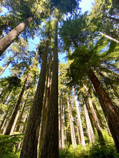
Cool Creek Trail #794 begins in the lush Still Creek valley of the Salmon-Huckleberry Wilderness, and immediately heads steeply uphill. The forest is thick with Douglas-fir, western hemlock and western red-cedars. Trekking poles recommended.


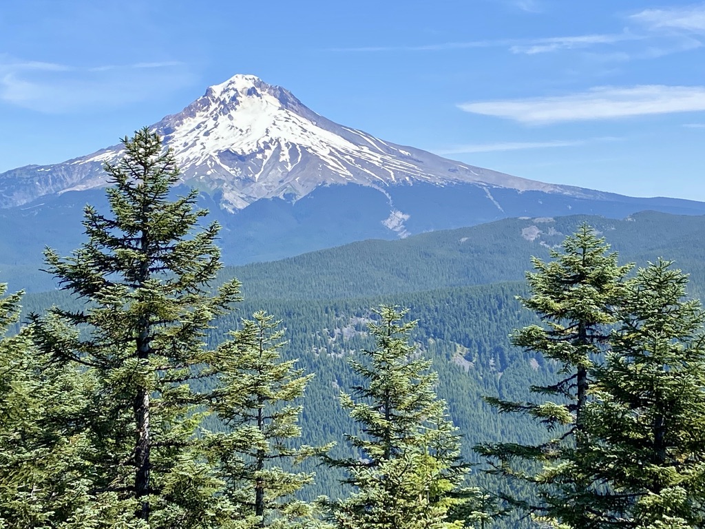
The trail reaches a ridge with a view of Flag Mountain, Zigzag Mountain and Mt. Hood. Then it continues to climb and passes over a trickling stream. The gradient becomes easier at a section of bear-grass, huckleberry and rhododendrons.

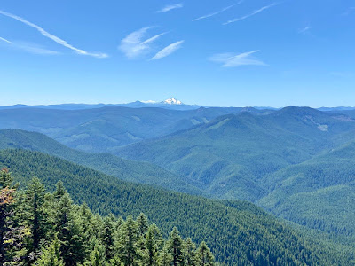
Following a series of rocky viewpoints, I recommend taking a short spur trail up to the ridge for a stellar shot of Mts. Hood, St. Helens, Adams and Rainier.

A right at the Hunchback Mountain-Cool Creek Trail Junction and then a quick left leads to the Devils Peak Lookout (elevation 5,045'). The fire tower is maintained by volunteers with a log book inside where overnight visitors can sign in; first come, first served.


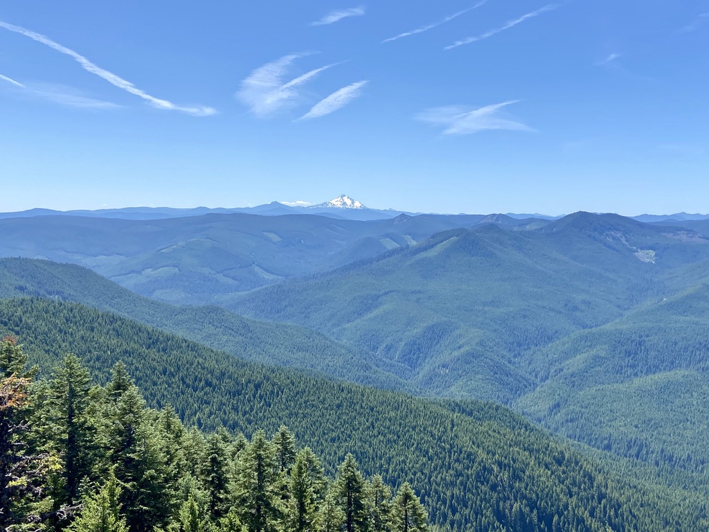
On a clear day, views extend south to Mt. Jefferson and east to the Devils Tooth rock outcropping and the Salmon River Valley. Now that the peak is no longer an official fire lookout, the surrounding trees are growing up and will soon obscure most of the expansive vistas. 10a-2pm RT.
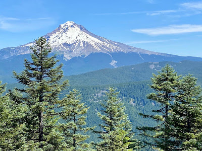


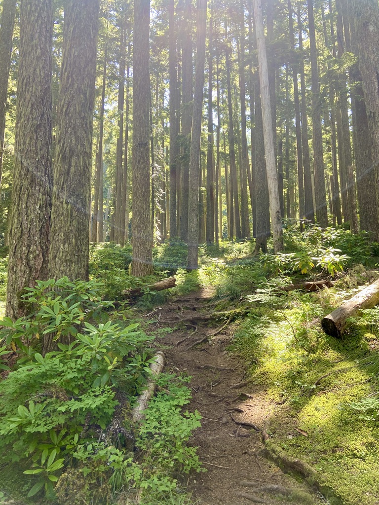
The trail reaches a ridge with a view of Flag Mountain, Zigzag Mountain and Mt. Hood. Then it continues to climb and passes over a trickling stream. The gradient becomes easier at a section of bear-grass, huckleberry and rhododendrons.

Following a series of rocky viewpoints, I recommend taking a short spur trail up to the ridge for a stellar shot of Mts. Hood, St. Helens, Adams and Rainier.

A right at the Hunchback Mountain-Cool Creek Trail Junction and then a quick left leads to the Devils Peak Lookout (elevation 5,045'). The fire tower is maintained by volunteers with a log book inside where overnight visitors can sign in; first come, first served.


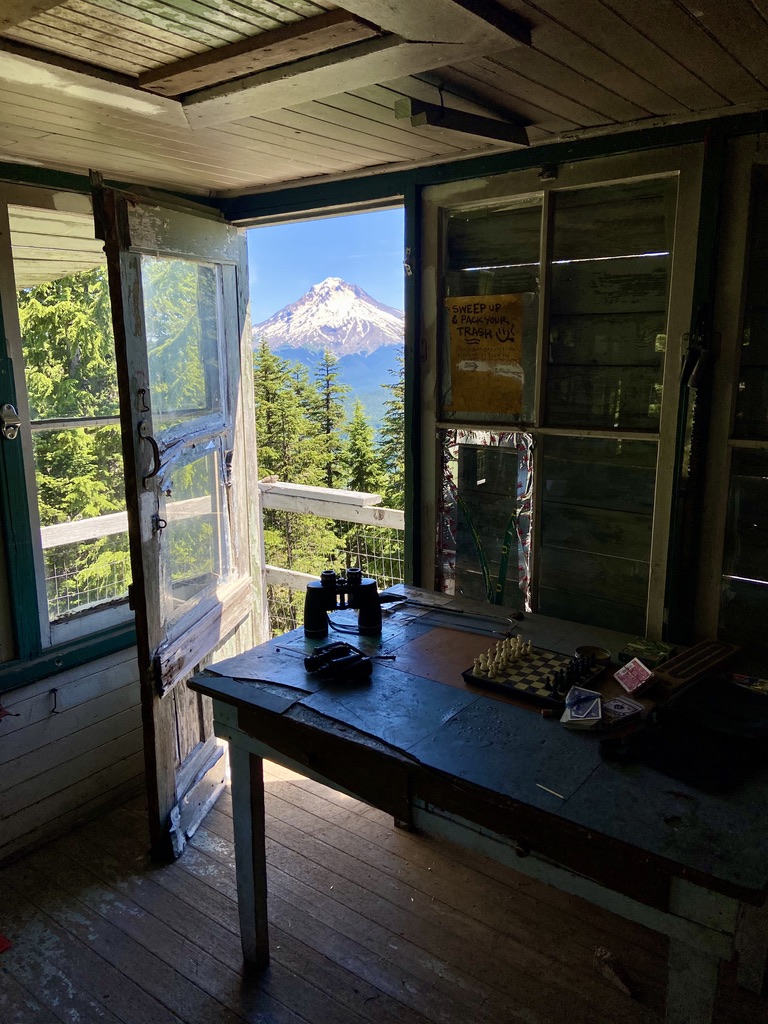
On a clear day, views extend south to Mt. Jefferson and east to the Devils Tooth rock outcropping and the Salmon River Valley. Now that the peak is no longer an official fire lookout, the surrounding trees are growing up and will soon obscure most of the expansive vistas. 10a-2pm RT.