
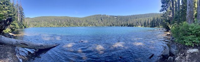
Wahtum Lake Trailhead is 1.75 hours east of Portland, with the second half of the drive through back roads; the last 10 miles are especially long, on a narrow winding road. The trip was worth it though, as I had the trail to myself apart from a few campers at Wahtum Lake. From the trailhead, take the Wahtum Horse Route on an easy 0.4-mile descent to the Pacific Crest Trail, near the lake shore.

Turn right on the PCT, and hike through the forest as the trail gradually curves above the lake, circling the east shore. The trail pulls away from the lake towards a junction with the Herman Creek Trail at 2 miles.


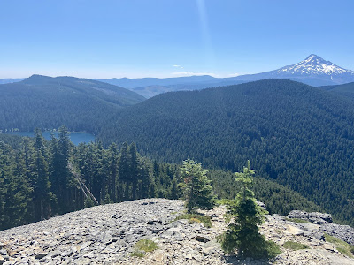
Continue on the PCT to the junction with Chinidere Mountain and begin climbing a series of steep, irregular switchbacks for 0.4 miles. As the route nears the summit, a couple of side trails lead to wildflower meadows (June/July) with views into Eagle Creek canyon.

Finally, the trail circles the platy andesite slopes of the summit before ascending to the top (4,673'). An unobstructed 360-degree view includes the major Cascade volcanoes--Mts. St. Helens, Rainier, Adams, Hood, Jefferson--with Wahtum Lake shimmering below.


 |
On the far side of the outlet, the trail reaches the Eagle Creek-Chinidere Cutoff Trail junction. Turn left and rejoin the PCT at the 4-mile mark. Pass more campsites and lake views before reaching the spur back to the trailhead. Note that this log describes a counterclockwise approach, but I would try it clockwise next time for a slightly steeper ascent and gradual descent. Pack bug spray.
 |
| Hiked 7/20/21 - 1.5 hours |