Monday, August 30, 2021

Hood to Coast

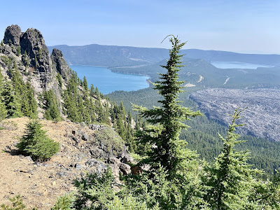
The annual Hood and Portland to Coast Relay is the largest and most popular running and walking relay race in the world, drawing participants from over 40 countries. Known as the Mother of All Relays, teams run 199 miles from the top of Mt. Hood (or walk 130 miles from Portland) to the Oregon coast. The event has sold out for 30 straight years and will celebrate its 40th anniversary next August.

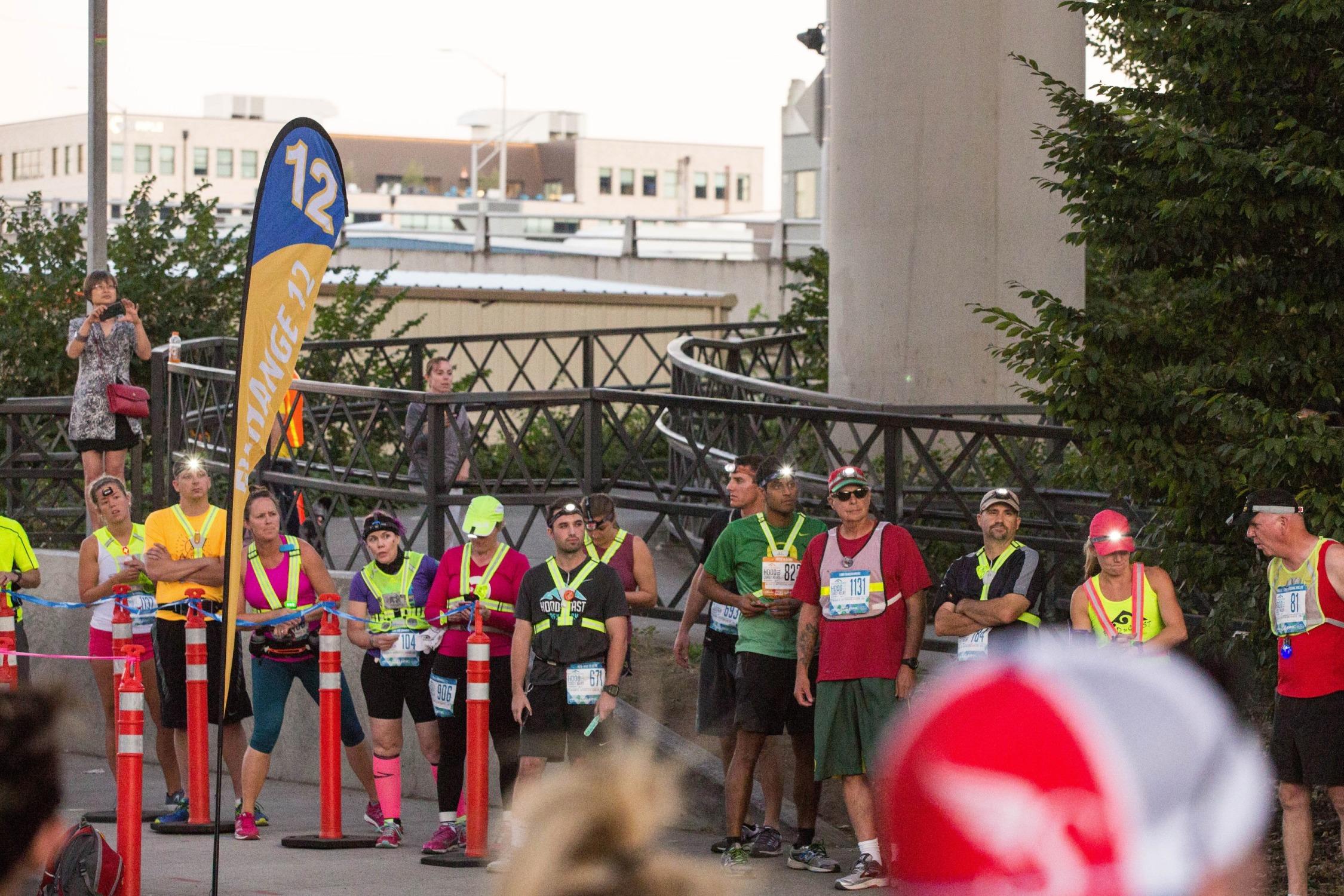
The course is broken up into 36 legs of varied difficulty based on distance, elevation and terrain. Most HTC teams have 2 vans, each with 6 runners. Each member runs roughly 5 miles 3 times throughout the duration of the race. Van 1 begins the relay with their first runner, while the remaining teammates drive to the end of Leg 1. Here the first runner will pass off a snap bracelet to the second runner, who will then run Leg 2. The van continues in this manner until all 6 runners have run once. At that point, Van 2 will meet at the major exchange where the last runner in Van 1 trades out with the first runner in Van 2. Van 1 gets a few hours to rest while Van 2 cycles through their runners. Like this, the vans leap frog the length of the course until the final runner in Van 2 crosses the finish line on the beach!

Last fall, Tom and I snagged a team in the lottery. While he had run HTC before, it was my first time participating in any relay. As a result, I learned the course, logistics and rules as we started recruiting runners and van rentals. We initially had a lot of interest in our team, but many of those leads fell through, which left us to pick up three runners on the HTC forum in order to fill our 12-member team. 

This year, the pandemic changed several aspects of the race, including maximized staggering of the start times in order to spread out all 1,000 teams. As a result, our first van began the relay at Mt. Hood's Timberline Lodge at 3:20am on Friday. Tom captained Van 1, crewed by his two brothers, their two friends and a seasoned relay runner from the forum. 


I captained Van 2, crewed by my friends Kyle and Kristin, their friend Conor and a ginger-bearded party animal from the forum. Unfortunately, our final runner from the forum did not show up, so things became interesting real quick. My first lesson from organizing a HTC team: things never go as planned. Luckily, we could still complete the relay with 11 runners, so we met Van 1 in Sandy around 7:30 am and distributed the extra 3 legs.

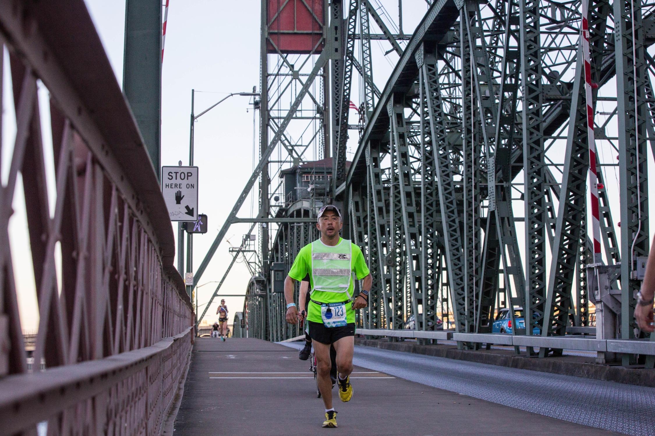
We were blessed with ideal running weather; overcast and comfortable temperatures. My first leg was a flat 6-mile stretch along the familiar Springwater Corridor in Portland. I ran Leg 12 around noon at an average of 9:45 per mile. Race pace is often quicker than in training because of the excitement, but I tried to keep pace knowing that I would have to run twice more. Due to an untimely train crossing, both vans were delayed getting to the next exchange to pick me up and drop Tom off. This exchange was also very busy because it is where the walkers begin Portland to Coast. Within 10 minutes or so, we sent Tom off and my van headed to our house to shower and rest for a few hours. 

We had planned to meet back up with Van 1 in St. Helens by 5pm, but got stuck in gridlock traffic on Highway 30--our last major hiccup. As a result, Tom had to run part of our van's first leg until we could catch up. This is not in accordance with the event rules, but we justified it being a non-competitive team that had zero chance of winning. I ran Leg 24, a 5-mile stretch along a road in rural Vernonia. At 10pm, with no light pollution, the night sky was lit up with stars. Just as I remember thinking how surreal it was, I looked up to see a shooting star. 9:30-minute miles.

During our final break, my van had hoped to get a few hours of sleep at a nearby school in Jewel, but we weren't allowed inside due to COVID; so it was camping outside or sleeping in the car. We chose the latter, but it was nearly impossible to get any shut eye in our cramped car parked at the loud exchange. 

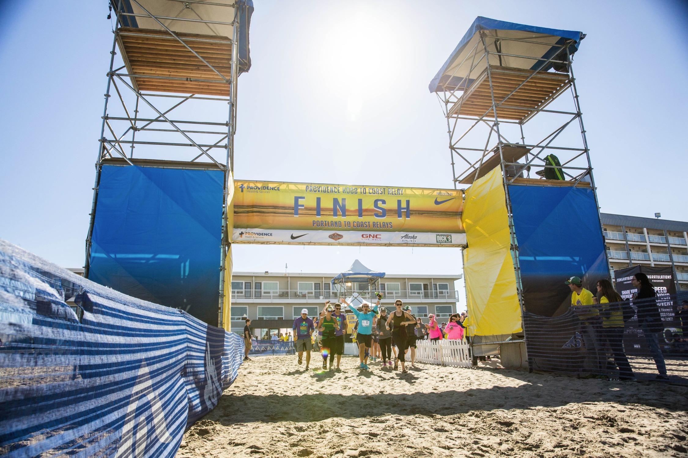
We felt like zombies, and nobody wanted to run again on stiff legs, but our team carried on and met Van 1 at 3:30am on Saturday. Luckily, we did not have issues finding them despite having lost cell reception. I finished the race on Leg 36, a 5-mile mostly paved section leading into Seaside. At a 9-minute pace, I was ready to be done. The team joined me to cross the finish line at 8:30am, completing the relay in about 29 hours. We headed back to Portland shortly thereafter, as we were too tired to wait for the party to start. That night, I slept like a bear for 12 hours.

Running HTC was one of my favorite experiences to date. I have so many funny stories and wonderful memories from the event. While I am hesitant to organize a team again, I would love to run it next year. What a blast!

Bucci, Simon, Conor, Elena, Kristin, Kyle, Dominick, James, Tom, Sam, Joe

Wednesday, August 18, 2021

Mt. Margaret

Every year, the August air subtly shifts as autumn creeps in. Nevertheless, I am always determined to make summer last as long as possible, squeezing in weekly hikes and paddles. My latest water adventure to West Linn's Cedaroak Boat Ramp is an excellent drop-in spot on the Willamette River.


Two weekends ago, Tom and I had planned to backpack in Mt. Margaret Backcountry. I was looking forward to my first backpacking trip, which would allow extra time to explore the area and experience it at all hours of day and night (unlike day hiking). We reserved our camping permits months ago, banking on the fact that August is usually dry and sunny. Unfortunately, however, we were unlucky with a sudden front of rain and fog.

Image

So when the rain and subsequent wildfire smoke cleared, I got an early start on Tuesday and drove back to the northeast side of Mt. St. Helens in Washington. The trek is almost 3 hours from Portland, which is one more reason to backpack. Mt. Margaret is an 11-mile (2,820' gain) out-and-back from Norway Pass Trailhead. This hidden gem offers unobstructed views of Spirit Lake and Mts. St. Helens, Adams and Rainier. 


The trail is narrow and partially overgrown, but beautifully lined with wildflowers and huckleberries. 


At 5,780', the summit is a rocky outcropping with room to wander. 

Image

As you can see, I was unlucky again as another patch of unfavorable conditions covered the area. What can I say, the Pacific Northwest climate is unpredictable. Next time, backpack loop in late July.

Wednesday, August 11, 2021

McKenzie River Trail

The McKenzie River Trail is my new favorite area to explore. The spectacular 26-mile trail follows the McKenzie River from its headwaters at Clear Lake in the Cascade Mountain range. It  is located 2.5 hours southeast of Portland, towards central Oregon. In case I didn't mention it in my previous post from Sunriver, last year's devastating Beachie Creek Fire has reconfigured the journey to this area; lush evergreen forests along Highway 22 have vanished into smoke. Pray for new growth and prevention of future wildfires.

On Monday morning, I arrived at Clear Lake, which was created from a lava flow that dammed the McKenzie River 3,000 years ago. The Great Spring is the source of the river, where water percolates up from lava rock below and forms a beautiful pool before flowing out into the lake. From the day use area, I picked up the trail winding south along the lake shore. I caught glimpses of the lake through the trees during the 1-mile forest stroll. A footbridge crosses the lake's outlet where the river heads south. I turned right at the junction with the McKenzie River Trail, but would complete the entire 5-mile lake loop next time; perhaps on a clear, autumn day. 


Despite the fires, the upper part of the McKenzie River Trail is very lush and picturesque, which includes Clear Lake, Sahalie and Koosah Falls. Some of the most rewarding places on the quiet west bank are along ice-blue sections of the river, where tumbling cascades drop through a dark and mossy forest corridor.


Koosah Falls offer different profiles throughout the year. In the driest months, there are two separate streams of water, while at full spate, the waterfall appears as a single 70' wide plunge. 


The McKenzie River Trail has several trailheads, which provide many options for hiking to various areas. With the car at the lake, I continued hiking south to find that the river disappears underground for a few miles. This part is hot, dry and less scenic than the upper section, though still mostly flat and narrow. However, the terrain becomes easier to trail run compared to the uneven roots and rocks further up.

After a few miles, I arrived at Tamolitch Pool. 1,600 years ago, the Belknap Crater belched a lava flow that filled the McKenzie River valley for several miles. The river then carved its way over and under the rock to plunge over a 50' waterfall into Tamolitch Pool, also known as the Blue Pool. These days, Tamolitch Falls only flows at times of exceptional rainfall or snow melt, but the pool continues to be a popular destination.


From the cliffs above the Blue Pool, the McKenzie pours through the underground channels into the cold and crystal clear oasis. The pool is 30' deep in the middle, but appears deceptively shallow. Water temperatures vary between 37 and 42 degrees. The lip of the dry falls can be reached by a quick scramble, and the shore of the pool can be accessed by a short descending path.


I eventually doubled back, and turned right at the junction with the Waterfalls Trail, which follows the east bank and offers a different view of the upper falls. Note that this section can also get crowded on weekends.


In total, I hiked about almost 13 miles (900' gain) in 3.5 hours. In the future, I want to set up a shuttle to complete the entire trail from north to south, either via backpack or trail run. Note that this track is also frequented by mountain bikers.


Back at Clear Lake, I couldn't leave before taking my paddle board out for a spin; easily the most beautiful place that I've paddled to date.


Monday, August 2, 2021

Sunriver

At the end of July, Tom's law school friends organized a post-pandemic reunion trip in Sunriver. Central Oregon's resort community is blessed with 300 days of sunshine a year; many residents of the wetter side of the Cascades have vacation homes in Sunriver. Located southwest of Bend near the base of the Cascade Range, Sunriver is bordered on the west by more than 5 miles of Deschutes River and on the north by the Deschutes National Forest. The unique forest environment of ponderosa and lodgepole pine sits on the edge of the high desert to the east.

7/28/21-8/1/21
Wednesday
Tom, Alina and I left Portland after work on Wednesday. We drove 3.5 hours via Mt. Hood before reaching our rental cabin in Sunriver. Our group of 11 kicked off the trip with a family dinner at home.

Thursday
The following morning, Tom, Alina, Eric and I hiked to Paulina Peak. The short but steep out-and-back trek is located in the Newbury National Volcanic Monument of the Deschutes National Forest (35 minutes away). Paulina Peak is the high point on the Newberry Caldera rim, the crater being the remains of one of the most massive shield volcanoes in North America. Originally, the mountain topped out over 10,000'. The City of Bend is situated on Newberry's 1,200 square-mile lava field.


The hike begins on the shores of Paulina Lake (or a mile closer at the Paulina Peak Trailhead) and rises through conifer forest to the summit at 7,984'. On a clear day (outside of the summer haze), the extensive views take in the Cascade Range from Mt. Adams in Washington to Mt. Shasta in California, as well as all the way southeast in Oregon to Steens Mountain. It felt good to be hiking at elevation again! Next time I visit the monument, I would spend time at the lake and its natural hot spring pools.

7/29/21 - 4 mi, 1300' gain - 1.25 hours 

Back in Sunriver, we spent the remainder of the day lounging around the house, playing games, pouring drinks, and watching the Olympics. Around dinnertime, we walked 2 miles to The Village at Sunriver. With such a large group, we were unable to find a table at the busy restaurants, so we picked up groceries at the market and grilled out. Sunriver Brewing Company looked like a cool spot.

Friday
We spent Friday morning in downtown Bend. That afternoon, John and I set out on bike, exploring Sunriver's 34 miles of paved pathways. Using the cruiser bikes at the cabin, we pedaled to Benham Falls and Lava Lands. This fantastic trail network is full of friendly people both on foot and bike, as well as many deer.


Saturday
On Saturday morning, I embarked on a solo adventure. Just 25 minutes away, Mt. Bachelor is home to one of the best ski resorts in Oregon. During the summer, it's open to mountain bikers and hikers.

I began the trek from the Little Pine lift in West Village. The first 2 miles are pleasant engouh, gradually inclining through forest with occasional views onto what would be ski runs. However, the final 1.5 miles is a steep grind through rocky terrain. This section of the trail is marked with white arrows that are painted on various rocks. The large summit area (9,065') has a few cauldrons and no distinct peak. The weather was oddly overcast and humid, but the 360-degree views were still dominated by Three Sisters and Broken Top. Not very crowded for a weekend.


7/31/21 - 7.5 mi, 2600' gain - 3.25 hours

Back at the car, I took my paddle board to nearby Sparks Lake--a large, shallow, trout lake that is the first of the high lakes from the Cascade Lakes Highway west of Bend. 370 acres of lake wetland are surrounded by another 360 acres of meadow, marsh or stream wetlands. The views of South Sister, Broken Top and Mt. Bachelor are spectacular.


Sunday
We took our time Sunday morning to pack up and say goodbye. Tom and I drove home via Highways 20 and 22 in order to assess the fire damage of last year's wildfires. It might have been nice to make a stop or two along the way, but we headed home to get ready for the week ahead. So long, central Oregon.