|
| 9/4-6 |
Date hiked: 9/4/19
Trailhead: Mt. Rose (North Tahoe)
Stats: 10.4-mile out-and-back, ~2,000' gain, 10,776' max
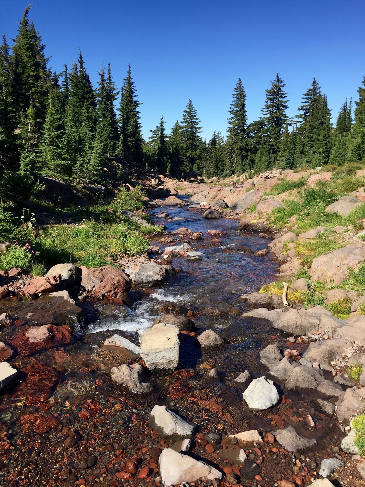
Synopsis: Easy 2.5 miles to waterfall before trail steepens to panoramic summit
Highlights:
-Second highest mountain in Lake Tahoe Basin
-On a clear day, summit views extend across the Sierras, Lassen Peak, Lake Tahoe, Nevada and northern Yosemite
-Crowded on weekends
-Second highest mountain in Lake Tahoe Basin
-On a clear day, summit views extend across the Sierras, Lassen Peak, Lake Tahoe, Nevada and northern Yosemite
-Crowded on weekends
My flight out of PDX captured a glorious sunrise over the Cascade Range that I have come to love over the past year. I had the privilege of flying under the care of the oldest U.S. airline pilot; his wife and children were part of the flight crew, having decorated the cabin with family pictures to celebrate the momentous retirement.


My pining for Oregon dissolved into excitement as the plane landed in Reno, NV. Wasting no time, I picked up my duffel and rental car, changed into hiking boots, and drove half an hour southwest to the summit mountain pass of the Mt. Rose Highway (SR 431). I could have saved an easier hike for my travel day, but it was on the way!

Mt. Rose resulted from volcanic activity that began 30 million years ago. It marks the transition zone between the Sierra Nevada and the Great Basin. I was joined at the lofty summit by a stream of butterflies, ladybugs and hawks. Due to looming storm clouds, I finished two hours earlier than expected; 10:45am-3pm RT.


From the trailhead, it was a 45-minute drive to South Tahoe. I stopped along the National Scenic Byway at Memorial Point and Cave Rock Vista Point.


Dinner/groceries at Grass Roots Natural Foods; lodging at The Mellow Mountain Hostel (just as laid back as it sounds).
THURSDAY (DAY 2): Emerald Bay State Park
Located 12 miles north of South Tahoe along the west shore, Emerald Bay State Park owes its spectacular scenery and dramatic alpine peaks, ridges and crystalline lake to the scouring action of glaciers from the Pleistocene Epoch (11,500-1,800,000 years ago). I spent the day exploring various trails in this area.


The Rubicon Trail extends for roughly 6.5 miles between Eagle Point and D.L. Bliss State Park. The popular 4.5-mile stretch between the Vikingsholm Estate at Emerald Bay and D.L. Bliss connects rocky points and sandy coves along the picturesque shoreline. I would recommend this easy trek for first-time visitors, especially those less interested in summit hikes. Note that parking at Emerald Bay requires a fee (though you can park for free at nearby turnouts) and an added mile with 500' elevation loss to reach the trailhead. Potentially consider setting up a shuttle system since it's an out-and-back route.


I encountered several beautiful blue birds during my quiet morning walk. Other local wildlife include salmon and trout, marmots and pikas, lizards, frogs and black bears. The sugar pine, found throughout the Sierra and Cascade mountain ranges, has the largest cone of any conifer species, up to 26" long. John Muir named the sugar pine the "king of the conifers."


Cascade Falls is a short trek from the Bayview Campground, leading to the top of the falls with views of Cascade Lake and Lake Tahoe.


Dinner at vegan cafe, Simple Bliss, before catching a stellar sunset at Lakeside Beach.

FRIDAY (DAY 3): Mt. Tallac


Dinner/groceries at Grass Roots Natural Foods; lodging at The Mellow Mountain Hostel (just as laid back as it sounds).
THURSDAY (DAY 2): Emerald Bay State Park
Located 12 miles north of South Tahoe along the west shore, Emerald Bay State Park owes its spectacular scenery and dramatic alpine peaks, ridges and crystalline lake to the scouring action of glaciers from the Pleistocene Epoch (11,500-1,800,000 years ago). I spent the day exploring various trails in this area.


The Rubicon Trail extends for roughly 6.5 miles between Eagle Point and D.L. Bliss State Park. The popular 4.5-mile stretch between the Vikingsholm Estate at Emerald Bay and D.L. Bliss connects rocky points and sandy coves along the picturesque shoreline. I would recommend this easy trek for first-time visitors, especially those less interested in summit hikes. Note that parking at Emerald Bay requires a fee (though you can park for free at nearby turnouts) and an added mile with 500' elevation loss to reach the trailhead. Potentially consider setting up a shuttle system since it's an out-and-back route.


I encountered several beautiful blue birds during my quiet morning walk. Other local wildlife include salmon and trout, marmots and pikas, lizards, frogs and black bears. The sugar pine, found throughout the Sierra and Cascade mountain ranges, has the largest cone of any conifer species, up to 26" long. John Muir named the sugar pine the "king of the conifers."


Just on the other side of Highway 89, a short but steep well-beaten path leads to Eagle Lake. This hike features cascading waterfalls, large granite peaks, lush vegetation, and lots of evergreens. Go early to avoid crowds.

Cascade Falls is a short trek from the Bayview Campground, leading to the top of the falls with views of Cascade Lake and Lake Tahoe.


Dinner at vegan cafe, Simple Bliss, before catching a stellar sunset at Lakeside Beach.

FRIDAY (DAY 3): Mt. Tallac
Date hiked: 9/6/19
Trailhead: Mt. Tallac
Stats (summer route): 10.2-mile out-and-back, 3,290' gain, 9,738' max
Synopsis: Ascend ridgeline with sweeping vistas of Fallen Leaf Lake before reaching Floating Island Lake and Cathedral Lake; switchback up a broad bowl to gain south shoulder; climb rocky talus to summit
Highlights:
-Highest mountain on Lake Tahoe shoreline
-Desolation Wilderness requires hiking permit (free at trailhead)
-360-degree summit over Lake Tahoe’s turquoise blue waters and surrounding Sierra mountain landscape
-Seasonal wildflowers (and mosquitoes), interesting rocks
-Back-country skiing in winter

I refueled post-hike with a fresh veggie wrap at Sprouts Cafe and beer at South Lake Brewing Company. Strong winds interfered with my hope to paddle board in the afternoon, compelling me instead to shop around town. Friday night in South Tahoe was abuzz with activity at nearby bars, night clubs and casinos.

First impression of Lake Tahoe? Positive! The shoulder season of September/October seems an ideal time to visit by missing the height of summer tourism while still enjoying pleasant weather. Nevertheless, I struggled to get a true feel for the local population/culture of residents. Who lives in Tahoe? I would be eager to experience the winter scene should I ever get back into skiing...


-Highest mountain on Lake Tahoe shoreline
-Desolation Wilderness requires hiking permit (free at trailhead)
-360-degree summit over Lake Tahoe’s turquoise blue waters and surrounding Sierra mountain landscape
-Seasonal wildflowers (and mosquitoes), interesting rocks
-Back-country skiing in winter

This was easily my favorite Tahoe hike; a straight-forward summit hike with rewarding vistas. A painted sunrise gave way to morning clouds and a strong breeze, but overall comfortable hiking weather. 7:30am-1:30pm RT.


I refueled post-hike with a fresh veggie wrap at Sprouts Cafe and beer at South Lake Brewing Company. Strong winds interfered with my hope to paddle board in the afternoon, compelling me instead to shop around town. Friday night in South Tahoe was abuzz with activity at nearby bars, night clubs and casinos.

First impression of Lake Tahoe? Positive! The shoulder season of September/October seems an ideal time to visit by missing the height of summer tourism while still enjoying pleasant weather. Nevertheless, I struggled to get a true feel for the local population/culture of residents. Who lives in Tahoe? I would be eager to experience the winter scene should I ever get back into skiing...